My land acknowledgment
My family owns a residential plot in suburban Chicago. I decided to find out what used to be there.
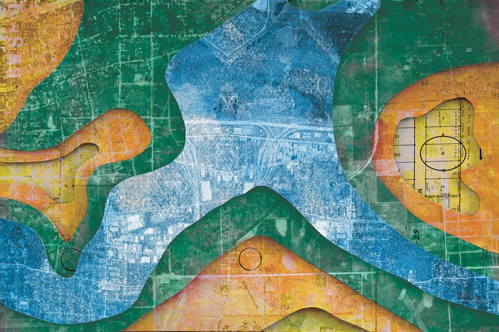
(Century illustration by Daniel Richardson)
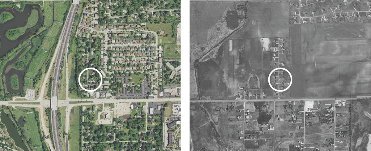
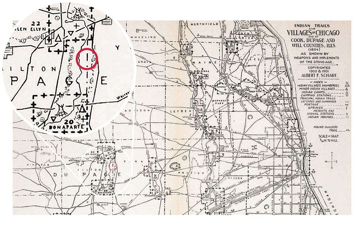
Other article images in order of appearance: 2023 (left) and 1956 (right) aerial photographs of DuPage Gardens subdivision in Glen Ellyn, Illinois, with the author's house circled / Plat of subdivision for DuPage Gardens with the author's lot circled, along with racial exclusion clause (inset) / US land patent awarding ownership of 120 acres of public land to Thomas Patchell in 1845 / Albert S. Scharf's 1900 map of Indian trails in and around Chicago as they existed in 1804, with the author's lot circled in red (all images public domain)
A long time has passed since we first came upon our lands, and our old people have all sunk into their graves. They had sense. We are all young and foolish, and do not wish to do anything that they would not approve, were they living. We are fearful we shall offend their spirits, if we sell our lands; and we are fearful we shall offend you, if we do not sell them. This has caused us great perplexity of thought, because we have counselled among ourselves, and do not know how we can part with the land. Our country was given to us by the Great Spirit, who gave it to us to hunt upon, to make our cornfields upon, to live upon, and to make down our beds upon when we die. And he would never forgive us, should we bargain it away. When you first spoke to us for lands at St. Mary’s, we said we had a little, and agreed to sell you a piece of it; but we told you we could spare no more. Now you ask us again. You are never satisfied! We have sold you a great tract of land already; but it is not enough! We sold it to you for the benefit of your children, to farm and to live upon. We have now but little left. We shall want it all for ourselves.
—Chief Metea, in defense of Potawatomi land at the signing of the first Treaty of Chicago in 1821
I am standing in the street on a quiet, suburban cul-de-sac in Glen Ellyn, Illinois, in front of a small brick house. The sounds of traffic come strongly from Roosevelt Road to the south and I-355 to the west. This house is my house. I’ve lived here with my family since purchasing it in 2015.
Read our latest issue or browse back issues.
But this house is on the traditional homeland of the Council of Three Fires: the Ojibwe, Potawatomi, and Odawa. This land has also nurtured Menominee, Ho-Chunk, Illiniwek, Miami, Sauk, and Fox nations. Until the mid-19th century, this area was home to the Potawatomi, who built villages along the Illinois River and its tributaries and hunted, fished, and traded throughout this region. The United States evicted the Potawatomi from their lands and transferred Potawatomi communities first to Missouri and then to Iowa and northern Wisconsin, where they still exist today. Depleted by war and hungry from the orchestrated loss of natural resources and crops, Potawatomi groups ceded the last of their traditional lands to the United States with the Prairie du Chien Treaty in 1829.
Sixteen years later, the United States awarded a patent to a parcel of that land to a US citizen named Thomas Patchell. Eventually it was subdivided into individual residential lots. One of them, lot no. 9, was bought and sold several times before my spouse and I purchased it in 2015. As with settler colonial societies around the world, the United States transferred Indigenous populations away from their homes and enclosed the land as property for private ownership. As with most land taken over by the United States, the land where my house sits has been owned by US citizens with European roots ever since.
That’s the short story. But as we dig more deeply into the details, more aspects of this story become relevant. I am going to retell this story in reverse—beginning with my ownership and tracing it backward toward the Potawatomi. While traditional chronology allows us to think of the past as behind us, reversing it forces us to encounter the ongoing presence of the past.
We begin in the present, looking at the landscape of an aging suburban tract.
As we reverse the film, we see the houses exchange owners. We watch people move out and in. The cars parked in the driveways change make and model, shape and color. We watch the trees shrink. We see flashes of red, white, and blue as homeowners decorate for each previous Independence Day. Before Highway 355 was built in the 1980s, there was less noise here. The houses looked less worn than they do now.
 In the 1950s, houses begin disappearing in a flurry of construction trucks and dust. Vacant lots take their place. But some of the brick houses remain, including the one I now live in. As the film continues backward, agricultural fields replace the entire neighborhood one street over. Sometime in the late 1940s the brick houses disappear. The trees that were mature in 2022 have disappeared altogether—there are no trees left. My scope of vision suddenly opens up, and I can see for a mile or more over the fields. It is 1945.
The street is gone, and I am standing in what might be a field of oats. For a fleeting moment, I see a team of surveyors. They are driving property markers deep into the ground, ground that has never been parceled before. These property markers are iron pipes used to indicate property lines for the residential lots that will soon be created here. The surveyors are guided by a plat map, created in an office somewhere—they are imposing the lines from the paper onto the landscape itself.
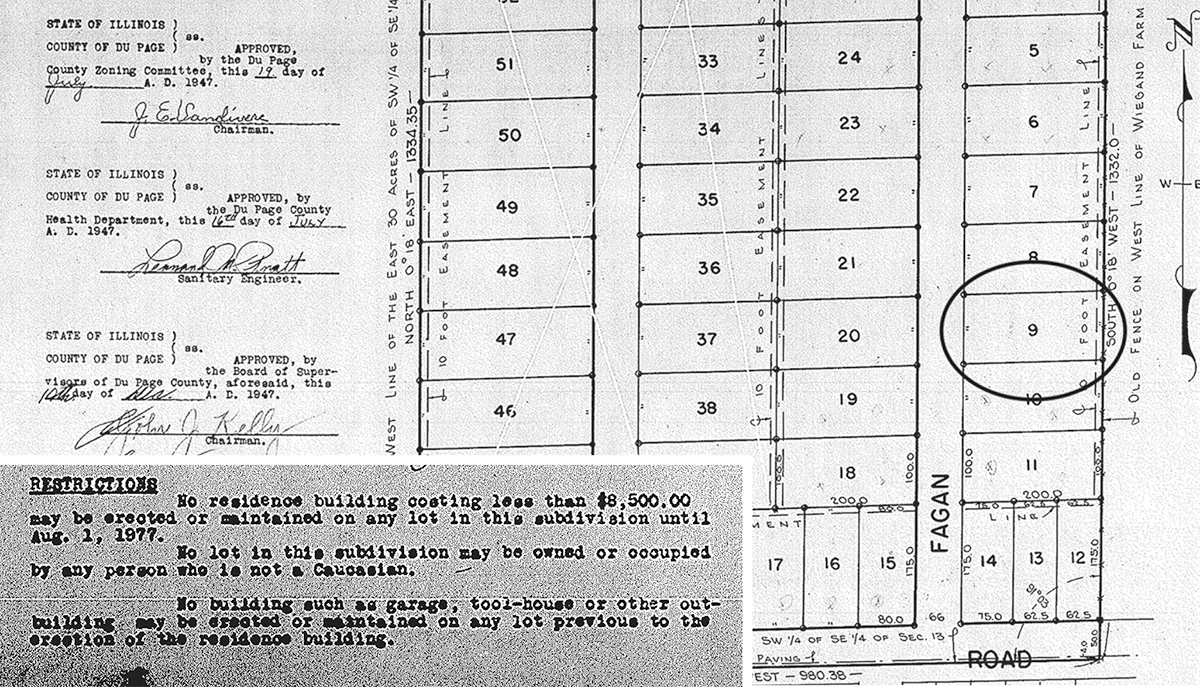
Although I observe the surveyors on the land, I cannot see the administrative action in the US General Land Office that enabled the surveyors to come. It is the plat of subdivision, submitted to a government office, that bureaucratically and legally transformed the land from agricultural to residential. What is also invisible as I watch the surveyors drive each pipe into the ground is the racial exclusion clause on the paperwork which restricts ownership of the lots to White people. Although the field looks the same, something monumental and lasting has just happened.
Now the camera rolls backward again. The small residential lots being laid out by the surveyors to create a White suburbia meld into a much larger parcel. Although I can’t see them, the boundaries of this larger parcel run 100 yards to the south, 100 yards to the east, and even greater distances to the north and west. Legally speaking, the land I am standing on at this point is part of this larger parcel which kept its boundary lines for 100 years. I notice a dilapidated farmhouse at the far corner of the field.
As the film rolls through the 1930s, ’20s, ’10s, and into the 19th century, I catch glimpses of farmers working in the fields—different farmers, one replacing another, just as residents do later in the suburban neighborhood.
I also notice the devolution of agricultural technology, mechanization in reverse. I am surprised by the overwhelming smell of smoke followed by a sudden, brilliant, orange flash on the horizon—it is the Great Chicago Fire in the distance. The year is 1871. The farmhouse in the corner of the field is brand-new; then it disappears and is replaced by a log cabin nearby. I catch a glimpse of Native Americans every now and then, walking through the field or riding by on the dirt road. The Civil War occurs mostly in distant places as I pass through the early 1860s.
Soon I see a man living in the log cabin, surrounded by a few small fields of beans and corn. This is Thomas Patchell. He grew up on the East Coast but followed a wave of settlers to Illinois to claim a piece of cheap and available land. He arrived with the first White settlers to the area. The railroad was still being built. He would have traveled on the Great Lakes to Chicago and then west along the St. Charles Road, which had been a Native American trail for centuries.
In the year 1845 there are no major physical changes to the land, but as in 1945, the main action is offstage. This is the year that Patchell received a patent from the General Land Office that legally transferred this parcel of land to him. With this patent, signed on September 1, 1845, by a bureaucrat in Washington, this land was claimed as private property for the first time in its history. This is the parcel that will exist without major changes to its legal borders for 100 years. I am struck by the immensity of what has just happened, even when nothing has changed on the ground except for the addition of Patchell’s little log cabin. And yet every subsequent event depends on this moment, this piece of paper.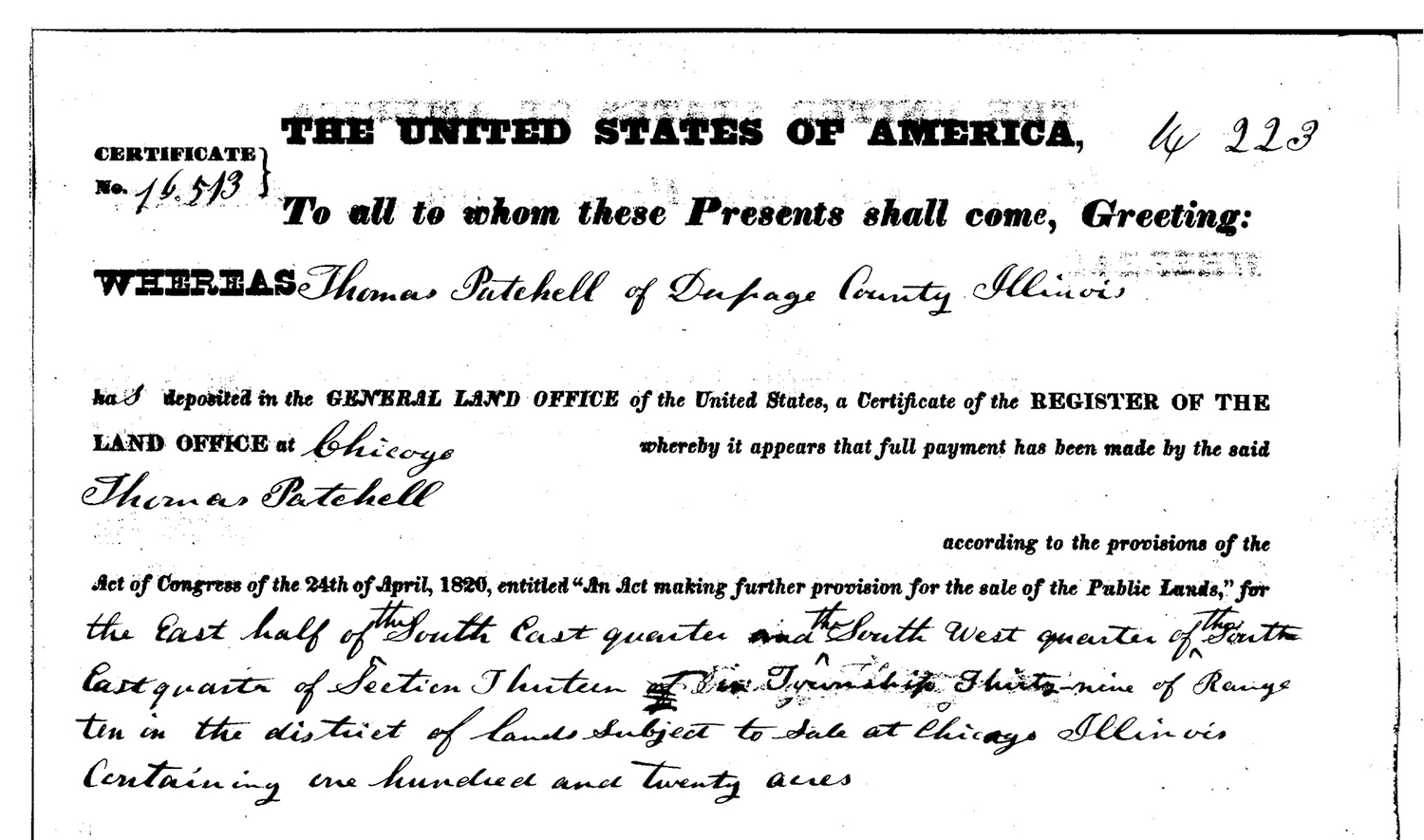
Patchell disappears from the scene, which is mostly a sea of prairie plants. Big bluestem, wild bergamot, and purple coneflower undulate as the wind passes across the hills, and small stands of trees are visible along the river. What small cultivation of crops Patchell maintained have now disappeared into the prairie. Although the United States government has sovereignty here, no private individual owns the land—it is state property. For a moment, I notice a lone man measuring the land with instruments, making notes on a map. He is surveying and platting the newly acquired land on behalf of the General Land Office. I continue seeing Native Americans come and go. In the summer of 1829, a treaty is signed 170 miles away in Prairie du Chien, and as that moment recedes into the future the legal status of the land shifts from being considered sovereign United States territory to being Indian country.
As I pass through the year 1812, I notice groups of Euro-American settlers moving quickly east—followed a day or two later by groups of Native warriors. Miles away, on the banks of Lake Michigan, the Potawatomi achieve a victory against the retreating soldiers and settlers at Fort Dearborn, but I know that the victory is short-lived because of all I’ve observed.
Now I hear flashes of voices behind me and turn again to the west. Every few moments I notice large Potawatomi groups rowing up and down the nearby river for seasonal gatherings with neighboring villages. Some are also on horseback. On occasion, I notice mixed groups of Euro-Americans and Natives, probably trading expeditions from a regional trading post. If I were to join a northbound group by canoe, ten minutes later, I would find myself in a Potawatomi village on the banks of the river. I see men, women, and children working, playing, and resting.
This is one of hundreds of Potawatomi villages throughout the western Great Lakes, linked through marriages, trade interests, common language, and common identity. By entering this village, I am entering one node of an active and diverse society flung across the Illinois, Kankakee, Tippecanoe, and St. Joseph Rivers and tributaries in modern-day northeast Illinois, Northern Indiana, and southwest Michigan. If I were to continue back through time, I would see successive generations of Native nations who called this place home for thousands of years, at least until 6500 BCE. But here the film stops, and I return to the present.
My world taught me not to think too hard about where this land came from. It inculcated a narrative that settlers were heroic and virtuous, telling stories that focused on the moral character, suffering, and sacrifice of these pioneers (as settlers are often known in these tales). They were men and women of conscience, as the narrative goes, who wanted to secure a better life for their families. But this narrative obscures more than it reveals. It lies about the presence and character of Indigenous Americans, about the deceptions and tactics by which the United States secured land, and about the human destruction involved in the removal of Native peoples from their land.
I framed this land acknowledgment in reverse chronology because I wanted to start with what I know, with what I see every day. The physical appearance of the land has changed so substantially that it would be easy to think of my cul-de-sac and the absent world of prairies and Potawatomi as different places. But they are actually the same place, utterly transformed under the machinations of land acquisition, enclosure, privatization, industrialization, and suburbanization. Part of the character of settler society is the wound it inflicts on reality by keeping these worlds separated, as if they are not intertwined with moral debts. One of the preconditions for my cul-de-sac was the Prairie du Chien Treaty and the removal of the two Potawatomi villages nearby.
I am a child of this settler society, and I also live in this shallow world of the present that buries the moral detriments of the past. When I look at my yard and street each day, I want the past to be brought to mind. I want to remember the Native communities that are a part of the history of this land—and in my remembrance to honor them. They are still here, their ongoing stories linked to mine in ways that have yet to be revealed.
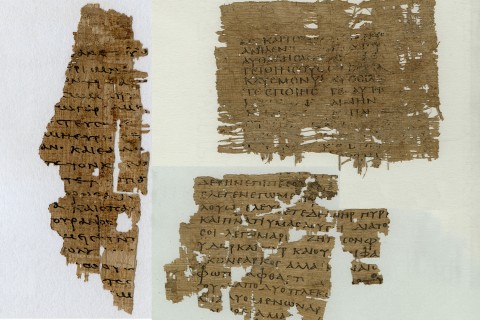
The details and documents included in this article are drawn from archival research with the Glen Ellyn and DuPage County historical societies, US land records, US tax records, and treaty records.